The Cosma Complex
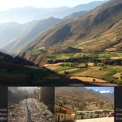
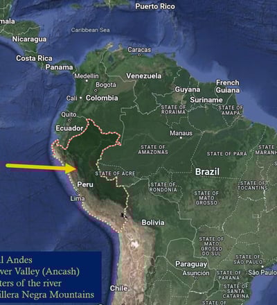
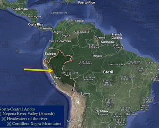
The Cosma Complex is a large multicomponent center located in the Cordillera Negra mountains, in the upper Nepeña River Valley Peru. The site itself extends over 250 hectares and includes two large platform mounds, prehistoric terraces, a hilltop fortress, Inca carved stone works, & a number of tombs & huanca, or sacred stones, embedded throughout the landscape.
Excavations in Cosma started in 2014, and over the last 11 field seasons, have revealed that Cosma was initially established during the Andean late Preceramic, with the current, earliest radiocarbon dates dating the Acshipucoto mound to 2900 BCE.
The Nepeña Valley: A Background
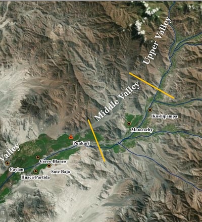
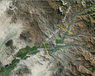
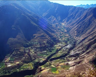
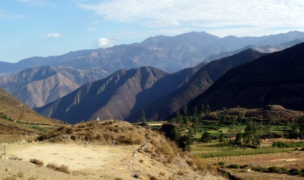
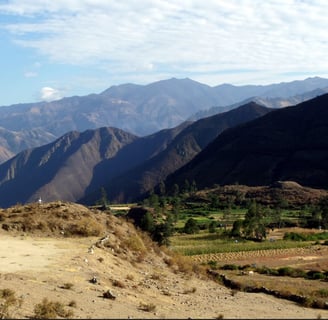
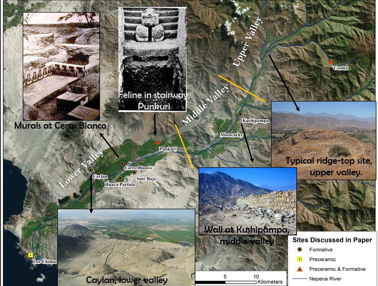
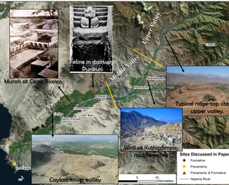
The Nepeña Valley historically was a significant geographic research area for understanding Initial Period and “Coastal Chavin” developments in the central Andes. Known archaeologically for the pioneering excavations of Julio Tello in the 1930s, the lower and middle parts of the valley have also been the focus of surveys and excavation since the 1980s, while work in the Upper Valley zone above the towns of Salitre & Jimbe were largely neglected until more recently.
A relatively small valley, the Nepeña witnessed major cultural developments during the late Preceramic (3000-1800 BCE) and Initial and Early Horizon Periods (1800-200 BCE). Since Julio Tello’s excavations at the temple complexes of Punkurí and Cerro Blanco, Nepeña has held a unique position in the study of interregional interactions. Major socioeconomic and religio-political transformations are now known to have occurred in the lower valley between 800 and 500 B.C. during what is known as the Nepeña Phase. Constructions during the previous Cerro Blanco Phase (1100-800 B.C.) temples with Chavín, Cupisnique and Sechín-related imagery stop at this time, when some groups nucleate at the lower valley site of Caylan.
Around Moro, recent survey work, indicates the existence of over half a dozen megalithic fortified settlements occupied during the Early Horizon. Farther up the valley, and into the Salitre and Jimbe basins, survey work by Daggett in the 70s and early 80s revealed the existence of a significant number of Early Horizon settlements, with ceramics and architecture, which were suggestive of highland influence and interactions (Daggett; 1984, 1987).
The current work at in the lower and mid valley point to the existence of multiple cultural traditions and spheres of interaction during the first millennium B.C. Following the demise of Chavín and Cupisnique influences and the associated abandonment of the ceremonial complexes of Cerro Blanco and Huaca Partida, at least two different cultural trajectories have been distinguished in the upper and lower valley, respectively.
These differing traditions are illustrated by distinct settlement patterns, and spatial distributions of sites, as well as differing architectural techniques and ceramic styles.
The Cosma Basin
The Cosma Complex is named after the community of Cosma, a small hamlet located in the Caceres District of the Upper Nepeña River. Though the historic and descendent community were founded in 1714, the archaeological itself is multifaceted, extensive, and is enmeshed throughout the modern day use and activities of life within the basin.
Archaeological Setting
The basin and surrounding ridges cover roughly 250 hectares and includes three ceremonial platform mounds, a hilltop fortress, above ground tombs, prehistoric terraces, domestic areas, as well as an Inca-Colonial-historical component.
Main Site Components
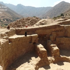
Excavations started in 2014 have focused on the two large huacas, or platform mounds, which date back to the Late Preceramic Period. Work to date has exposed at least 9 Late Preceramic temple-rooms within the 2 large pyramid mounds, known locally as Acshipucoto & Kareycoto.
Geography
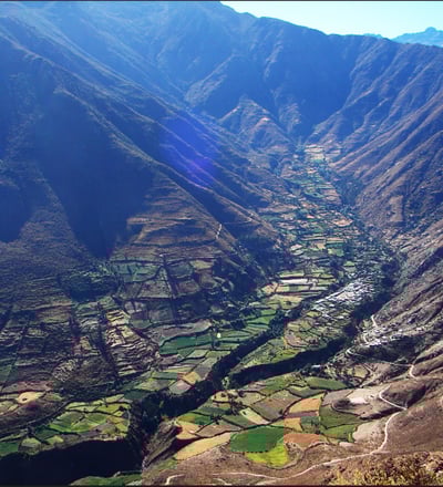
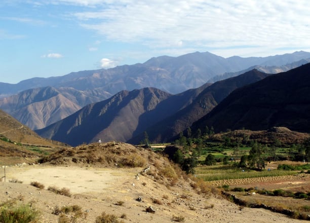
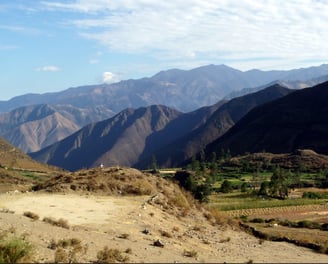
The basin is located at the headwaters of a branch of the Jimbe River, at an elevation of 2650masl. Uniquely situated in an isolated box canyon between two mountain passes into the Callejón de Huaylas.
The Huacas -- Kareycoto & Acshipucoto
Kareycoto, the larger of the two mounds was built on a 250 m long man made platform which is oriented N-S forms the base of the construction. An 18m tall mound top is situated on the southern end of this platform. In Quechua, Karey refers to "the Gift" or "Giving," while "Coto" refers to a mound or "communal place of gathering." Karey is considered by the local community to be a female mound or entity.
The term Huaca, loosely translated from Quechua, refers to any form of the sacred, animated, and with personhood. Though specifically she falls into the most common category of huaca, the pyramid mound, huacas can be sacred stones, ceramic pots, relics, etc. We know now from our excavations she was initially brought into being approximately 5000 years ago, and reached almost her full height of 18 m at that point in time.
The Acshipucoto mound measures 10m in height and is located half akilometer across the ravine, due south of Kareycoto. Acshipu refers to a "central" place, or "concentric," which is fitting given the circular room uncovered during the 2014-2016 field seasons. Referred to as the "AC-1" Chamber, This room -- which measure 6m in diameter, was constructed with 6 wall niches, a split level floor, and a central hearth, all features reminiscent of what has been reffered to as the Kotosh/Mito tradition (a Late Preceramic and Initial Period architectural religious phenomenon traditionally associated with the neighboring highlands).